")
")
Vermessung Cabouy
Participants: Tobi Petzinger, Fred Petzinger, Tobias Ziegler, Arnde Arndt, Roland Kring, Tobias Schmidt, Oli Kurtz, Tim Löffler, Manuel Fiore, Manu Schoch, Peter Gärtner.
The Cabouy is known for rarely good visibility and fast response to rainfall. Therefore, we anxiously observed 2 weeks in advance the weather patterns on site and kept our own little weather statistics to get as realistic an assessment of the situation as possible in advance.
After the Petzinger family had already arrived the night before, the rest of the group coincidentally arrived within 30 minutes quasi simultaneously. We had looked around for strategically located accommodation and had come across the Domaine de Gibert (http://www.domaine-de-gibert.com) in a report by Niko Gerdau (www.trimix-nord.de).
This time we had Tobias Schmidt on board as a guest. He wanted to support us in surveying. After hello occupation of the rooms, coffee, there was an introduction of Tobias Schmidt and Peter in the surveying topic.
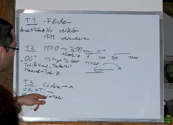
After it was explained how a polygon train is recorded and how the spatial dimensions of a cave are measured, it was time to distribute the tasks to the individual teams. It was important to us that each team member could contribute to the project and that there would be a lot of diving.
Day 1
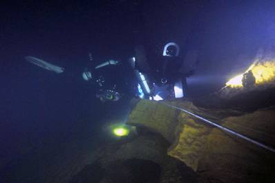
After the call of the alarm clock at 7:00 we went directly through the bathroom for breakfast. Amazingly on time we could start around 9:00 direction Cabouy, which we reached after only 18 min driving time. Arrived on site, we first inspected the whole scenery. First we defined a corridor through the UW flora as well as the place to put down the needed equipment (scooters; stages). A particular concern for us was to minimize disturbance to the toad and frog spawn in the weeds.
After a surveying-drying exercise in the bush, the tasks of the individual teams were talked through in detail.
Team 1 (Roland, Arne) had 3 tasks:
Check visibility. If they would not reappear after a short time, it was clear that the conditions were sufficient for our plan.
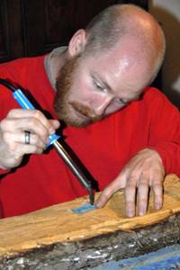
Establish a continuous leading line up to Pou Meyssen (PM) (unclear if heavy winter bulk had torn the line). It turned out that the line from the 5m point 500m inward only hung in shreds. Roland and Arne had to mend the line in at least 20 places. 3rd: Continuous ascending numbering of all fixed points. The tags for this we had made the night before from webbing with soldering iron and Edding.
Diving time ca.3h.
While Roland and Arne were getting ready, Tobias, Manuel and Peter went to the PM to check the situation. In particular, a stainless steel tab was placed in the rock to reattach the safety rope for the exit from the PM. In addition, Manuel did not edge the PM yet.
Team 2 (Tobi P., Fred, Manuel; Tobi Z.):
Surveyed the polygon train from P15 towards the exit (100bar from a stage, set cookie, start). Dive time good 2h.
Team 3 (Tim, Oli, Tobi S., Peter, Manu)
Task: Measuring of the polygon course from Cookie of team 2 in the direction of PM, so far until abort criterion is reached (time, gas, distance). Scooter deposited at cookie, reached P33. Dive time 3h. Funny frog columns of up to 10 individuals were sighted at 24m.
After a short stop at the supermarket we had 5kg kettle goulash sponsored by Tobi P. in the evening. After the data had been provisionally prepared, we were amazed at what we had accomplished on our 1st surveying day: 33 measuring points of the polygon train, about 600m, had been surveyed. Already now the character of the Cabouy could be clearly recognized: Course in eastern direction, characteristic entrance dump at 30m, highest point 5m at 490m, the T's and jumps passed so far were already marked. Tired and anxious to solve our self-imposed task the next day (it had started to rain) we sank into our beds.
Day 2
Again the alarm clock woke us up much too early for a vacation. After breakfast we arrived at the Cabouy around 9:15. The task for the day was to complete the polygon course and measure the spatial dimensions at each survey point. Although the spring pond showed no sign of worsening conditions, we decided to send a team ahead to clarify visibility and flow conditions. Manuel and Tobi P. were completely supported by the whole team and were able to descend after only 10min of Rödel time. They could announce after a few minutes that the flow had increased a bit, but the visibility was unchanged from the previous day.
Team 1: Tobi P, Fred, Manuel, Tobi Z, record room dimensions from measuring point 15 towards the exit. Dive time good 2h.
Team 2: Roland, Arne: from cookie room dimensions in direction PM to reversal criteria, leave cookie for team 3. Dive time 3h.
Team 3: Tim, Oli: measuring chimney. Dive time 2h.
Team 4: Tobi S., Peter, Manu: Record remaining polygon course from P 33 to water surface PM, out to record course dimensions to cookie Roland, Arne. Record polygon course and dimensions of loop. Dive time 4:15h.
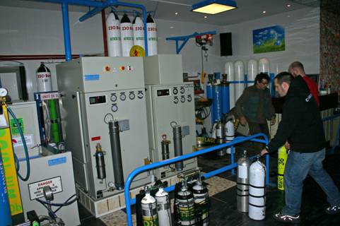
In the afternoon OC team went to Andre Grimal's luxury filling station for filling. Team 2 and 3 waited until team 4 was out of the water and helped with exit and loading. Team 4 measured in Pt. 0 and PM via GPS and additional survey distance to have a reference for the location of the cave in the terrain as well as the accuracy of our measurements. After a quick stop at the supermarket, everyone met back at Domaine de Gibert.
In the evening we had the 2nd portion of kettle goulash. After the final discussion Tobias and Peter retired for further preparation and examination of the data. The evening ended with preparations for the last day of diving - planned were dives in the Ressel.
Day 3: Ressel
Free fun diving was the order of the day - each according to his own taste and comfort zone: Roland and Arne dived the deep loop, Oli, Tim Tobi Z. looked at the first deep T, Tobi P. and Manuel swam to the shaft and surveyed the shallow loop from all angles. Tobi S., Peter, Manu made an excursion and exploration day.
In the evening the first detailed plan of the Cabouy was finished and the cars were loaded. Everybody was happy about the achieved result - since it was our first surveying project, we were not sure how far we would get. And therefore we were doubly happy about the achieved result!
Day 4
Journey home
Report OC Team
1st diving day - Diving team 2 (OC)
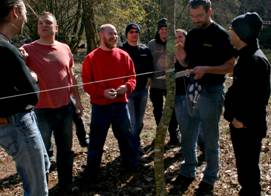
After a short breakfast, to everyone's amazement, we actually left on time on the first day of diving. The cave pool made, as on the previous day, an excellent impression. While dive team 1, consisting of Roland and Arne, got ready for a first dive to check the line situation and to give numbers to all tieoffs as measuring points, the rest of the team had fun in the forest with a dry run. Using 30 meters of caveline stretched between the trees, Peter and Tobi S. illustrated once again what had already been discussed the night before. So also the last questions could be clarified before it went into the water.
We, dive team 2, quickly agreed to dive with 2 stages. Since we could not estimate yet how well we would get on with the measuring and for us OCler the gas quantity was in this case the limiting factor, we decided to measure the cave from the inside to the outside. Half a stage was planned for the way into the cave, 1 1/2 stages were available for the survey work on the way back. In the first moment this planning may seem very conservative. But in order to work cleanly and without time pressure, you actually need 3 times the amount of gas than if you just float in and out.
After the usual checks, we set off armed with writing tablets, compass and tape measure. Tobi Z. (the only RBer in the OC team : ) ) and Manuel, followed by Fred and Tobi P. slowly advanced into the cave. After the first stage in the team had breathed down to about 100 bar, we marked the measuring point 15 which we had reached with a cookie. This served diving team 3, which consisted exclusively of PSCR divers, as a starting signal for their measuring distance. We started to work our way back towards the entrance of the cave. We split our team of 4 into two buddy teams. While Manuel and Tobi Z. stayed at the respective survey points with the end of the tape measure, Fred and Tobi P. swam back to the previous survey point. Fred handled the tape measure like a reel, so we could determine the exact distance relatively precisely. As soon as we had noted the distance, Fred pulled the tape measure three times and then began to slowly roll it up. As soon as Tobi Z. and Manuel arrived with the end of the tape measure, the procedure started again. To determine the correct direction, Manuel measured in the direction of the cave exit using a compass, Tobi P. took the coordinates from the other end of the tape measure in the opposite direction. By measuring in the opposite direction we were able to check each determined value for correctness by a second one.
In addition, we also noted the exact depth at each measuring point. All beginnings are difficult : )The first two or three measurements were a bit tough, but once we were used to each other it worked like clockwork.
In this way we were able to measure a total of almost 300 meters of polygonal course during the two-hour dive.
Before heading back to the house in the evening, we paid Andre Grimal (http://www.gonflage.com) a visit to have our stages filled again for the next day. When you stand in front of his filling machine for the first time, you easily get wet eyes and wobbly knees. A dream for every self-filler! And at decent prices too!
We let the day end with a huge pot of goulash with potatoes and baguette and fell around 24 o'clock in the beds, after all, we have agreed for the next day to wake up at 7 o'clock!
Day 2 - Dive Team 2 (OC)
After an unspectacular breakfast and the short 15 minute drive to Cabouy we were not sure if the conditions would allow reasonable work on the second day. There were fears that the rain of the previous night could throw a spanner in the works. During a half hour check dive Manuel F. and Tobi P. could convince themselves that there were fortunately no impairments of the visibility and we could continue our work as planned.
The division of the buddy teams was identical to the previous day, which also applied to the gas planning. Manuel went with Tobi Z. and Fred with Tobi P. into the water. The plan was to record the passage dimensions so that the cave plan that was to be created at the end would not only consist of connected lines with depth information, but would result in a nice 3D image.
When we reached the measuring point where we wanted to start, Fred and Tobi P. climbed up to the cave ceiling to note the minimum depth above the measuring point. Meanwhile Manuel and Tobi Z. started to measure the passage width to the left and right of the measuring point. Fortunately, the visibility was good enough that we could communicate perfectly. Determining the minimum depth under the ceiling was of course much faster than measuring the aisle width. This allowed Fred and Tobi P. to illuminate the working area of the buddy team working on the cave floor and to support the two of them a bit. After all relevant data had been determined Manuel F. and Tobi Z. signaled this to the top and we swam on to the next measuring point. Fred and Tobi P. stayed under the cave ceiling during the whole dive. Although it was not possible to see the line from there, we still decided to do this. Since someone from the 4-person team was permanently on the line, the visibility was good enough to communicate with the lamps through the entire passage and an ascent at each measuring point would have resulted in a textbook yoyo dive with the existing passage heights, this was the best solution in our eyes.
After about two hours we had worked through the area we had planned and left the water after 15 minutes of oxygen deco.
Also in this evening our way led us to Andre Grimal, before we fell after a cozy dinner but somewhat exhausted in our beds.
3rd diving day - Off to the Ressel!!!
Today fun diving was on the program! Since fun also has its price, all alarm clocks rang at a damn ungodly hour : ) Due to the trunk plague that had spread a little, we unfortunately could not all enjoy this beautiful cave on this day. Although Peter was not well-disposed to us today and let it rain heavily in stages, but that could not stop us! We quickly got used to the mud and prepared our equipment at the entrance area.
Roland and Arne tackled the 4th T (about 1100m penetration) and the deep loop. Both armed with a PSCR and 2 scooters.
Tim, Oli and Tobi Z., all also with RB and scooter, took on the 3rd T (approx. 830m penetration). The 3 guys took a backup scooter with them in the team.
Tobi P. and Manuel wanted to have a look at the shaft at about 390 m from above and dive the flat loop from the 2nd T to the 1st T today. Both as it belongs to connoisseurs on foot on the way. Since the two were true to the motto much helps much, with each 2 Stages EAN 32 on the way and visibly had their fun, they made the flat loop twice.
The conditions were very good and everyone got their money's worth.
Tobi P. and Manuel showed up first after almost 2 hours. Followed by the trio,Tim, Oli and Tobi Z..
After a pleasant break Tobi P. and Manuel grabbed for their 2nd TG each a Stage EAN 32 and a Scooter and visited, because it was so nice, the shaft a second time. On the way down they met Roland and Arne, who just finished their deco and surfaced.
After the equipment was laboriously dragged back into the cars we went back to our accommodation. On the way we made a short stop at the ELEKTRIKER and provided us with plenty of good food which Arne prepared for us excellently!
We let the evening end comfortably with a glass of wine or ne bottle of beer and went us not too late in the beds.
Well, about the journey home you do not need to tell much!
The result: The plan
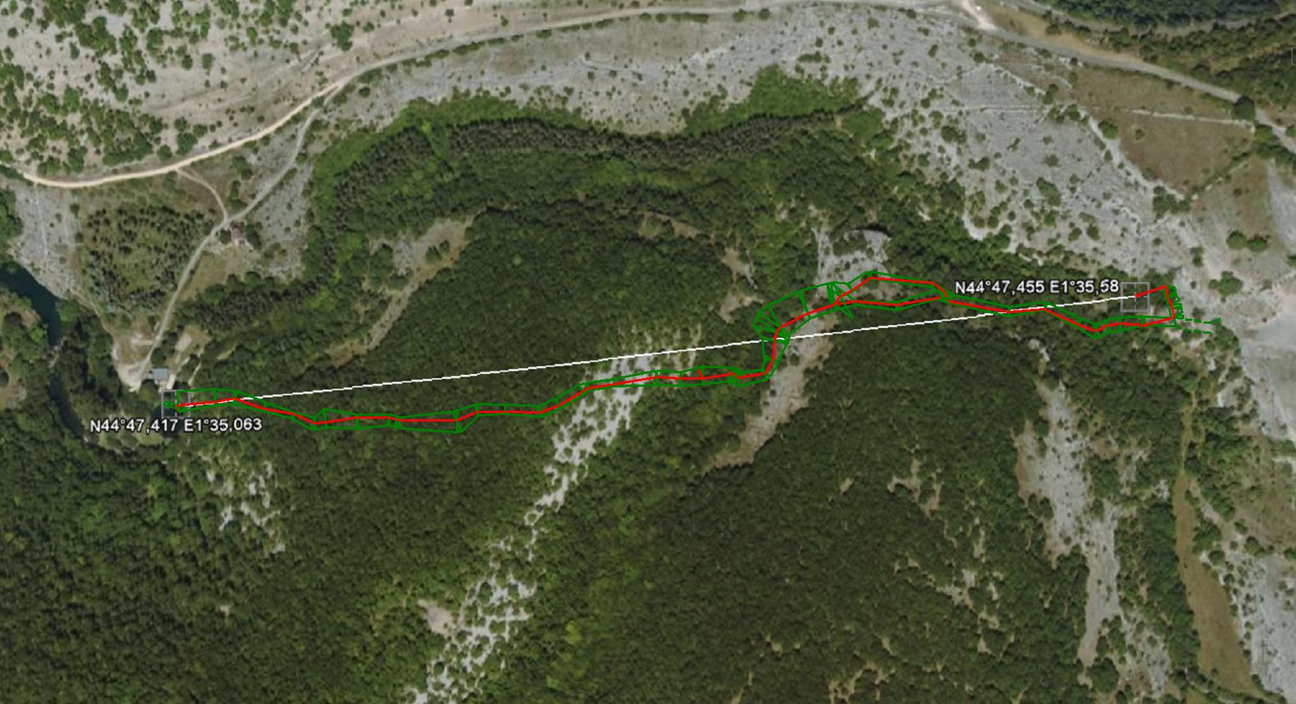
For our first survey as a team, we are amazed at the result! We had hoped, but only the uncertain conditions regarding the visibility made us doubt. In total, a corridor length of 983m was surveyed, the longest single survey train was 49.3m long. The total length of the lope is about 150m. The largest depth is 32m, the smallest (at the level of the line) 6m. Almost 60 measuring trains were measured. The starting point was the chain below the jetty in the Cabouy and the fixed point where the guide line is attached to the Pou Meyssen. These points were measured with GPS - at the Pou Meyssen an auxiliary measuring train was necessary so that the GPS device had reception. Overall, our total survey train has a deviation of only 24m from the GPS stations! In the overlay with the aerial photo you can see that the course of the cave does not follow the dry valley.
Oh yes - if there is an expert out there in the Internet in the matter of Wincompass - I would have there still a few questions and would be pleased about a contact!
Many thanks again to Tobias Schmidt, without whose active support and explanation the project could not have taken place!
In this sense,
Your Cavebase
Gallery


Plan